Geographic Information Systems (GIS) professionals, surveyors, cartographers, and remote sensing specialists work with coordinate systems every day. Yet, one of the most common questions among GIS beginners is:
Should I use WGS84 or UTM?
Choosing the wrong coordinate system can lead to inaccurate measurements, misplaced features, distorted maps, and costly project errors. Understanding the difference between these two coordinate systems is essential for producing reliable spatial data and analyses.
In this guide, we’ll explain what WGS84 and UTM are, how they differ, and when each should be used in real-world GIS projects.
Understanding Coordinate Systems in GIS
A coordinate system is a framework used to locate positions on the Earth’s surface.
Without coordinate systems, a GIS application would not know where to place features such as roads, buildings, pipelines, rivers, or administrative boundaries.
Coordinate systems provide a common language for representing geographic locations.
The two most commonly encountered systems in GIS are:
- WGS84 (World Geodetic System 1984)
- UTM (Universal Transverse Mercator)
Although they are often used together, they serve different purposes.
What is WGS84?
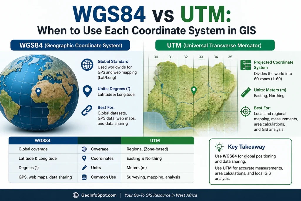
WGS84 stands for World Geodetic System 1984. It is the global standard coordinate reference system used by GPS devices worldwide.
WGS84 represents locations using:
- Latitude
- Longitude
These coordinates are measured in degrees.
For example, the coordinates of Abuja, Nigeria can be represented as:
- Latitude: 9.0765° N
- Longitude: 7.3986° E
WGS84 is designed to provide a consistent global reference framework, making it ideal for worldwide navigation and mapping.
Key Characteristics of WGS84
- Global coordinate system
- Uses latitude and longitude
- Coordinates expressed in degrees
- Standard for GPS and navigation systems
- Suitable for web mapping applications
- Excellent for storing and sharing global datasets
What is UTM?
UTM stands for Universal Transverse Mercator.
Unlike WGS84, which uses latitude and longitude, UTM divides the Earth into 60 vertical zones, each spanning 6 degrees of longitude. UTM is a projected coordinate system divided into zones. Learn more about coordinate systems and map projections in the Esri documentation
Within each zone, locations are measured using:
- Easting (meters)
- Northing (meters)
A typical UTM coordinate might look like:
- Zone: 32N
- Easting: 543,210 m
- Northing: 1,003,450 m
Since measurements are in meters, UTM is particularly useful for distance calculations, engineering projects, and land surveys.
Key Characteristics of UTM
- Divides Earth into 60 zones
- Coordinates measured in meters
- High positional accuracy within each zone
- Ideal for local and regional mapping
- Excellent for distance and area calculations
- Widely used in surveying and engineering
Visualizing Latitude and Longitude
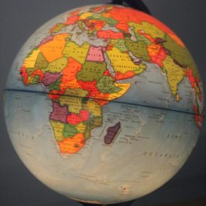
To understand how WGS84 works, it helps to visualize latitude and longitude lines intersecting on the globe.
30° N, 45° E: latitude is written first, and the pair identifies the marked location
Latitude lines run east-west, while longitude lines run north-south. Together, they create a global grid system used by GPS devices and mapping platforms.
WGS84 vs UTM: Key Differences
| Feature | WGS84 | UTM |
|---|---|---|
| Coordinate Type | Latitude & Longitude | Easting & Northing |
| Units | Degrees | Meters |
| Coverage | Global | Regional |
| Accuracy for Distance Measurements | Moderate | High |
| Accuracy for Area Calculations | Moderate | High |
| GPS Compatibility | Excellent | Requires Conversion |
| Surveying Applications | Limited | Excellent |
| Engineering Projects | Not Recommended | Recommended |
| Web Mapping | Excellent | Less Common |
When Should You Use WGS84?
WGS84 should be your preferred choice when working with global datasets or GPS derived coordinates.
Use WGS84 For:
1. GPS Data Collection
Most GPS receivers output coordinates in WGS84 by default.
Examples include:
- Garmin GPS devices
- Smartphones
- Vehicle tracking systems
- Drone GPS systems
2. Web Mapping Applications
Popular mapping platforms use WGS84 as their underlying geographic reference.
Examples include:
- Google Maps
- OpenStreetMap
- Bing Maps
- ArcGIS Online
3. Global Datasets
When working with datasets covering multiple countries or continents, WGS84 provides a common coordinate framework.
4. Navigation Systems
Marine, aviation, and vehicle navigation systems rely heavily on WGS84 coordinates.
5. Data Exchange
When sharing data internationally, WGS84 is often the preferred coordinate system because it is universally recognized.
When Should You Use UTM?
UTM is generally the better choice when precision measurements are required.
Use UTM For:
1. Land Surveying
Surveyors commonly use UTM because coordinates are measured in meters, making calculations straightforward.
2. Engineering Projects
Examples include:
- Road construction
- Railway design
- Utility networks
- Building development
3. Area Calculations
Calculating land parcels in WGS84 can produce misleading results because degrees are angular measurements.
UTM provides more accurate area calculations.
4. Distance Measurements
When measuring the distance between features, UTM is significantly more reliable.
5. Utility Mapping
Utility companies frequently map:
- Water pipelines
- Gas pipelines
- Electricity infrastructure
- Telecommunications assets
using UTM coordinates.
Why UTM is Better for Measurements
Distance calculations are one of the primary reasons GIS professionals project their data into UTM.
The standard distance formula used in coordinate geometry is:
d=(x2−x1)2+(y2−y1)2
This formula works best when coordinates are expressed in linear units such as meters, which is exactly what UTM provides.
UTM Zones in Nigeria
Nigeria spans multiple UTM zones:
UTM Zone 31N
Primarily covers western Nigeria.
UTM Zone 32N
Covers central Nigeria, including Abuja and many northern states.
UTM Zone 33N
Covers parts of eastern Nigeria.
GIS professionals working in Nigeria should always verify the appropriate UTM zone before beginning a project.
Using the wrong zone can shift data by hundreds of kilometers.
Common Mistakes GIS Users Make
Mixing WGS84 and UTM Layers
A common mistake is combining datasets stored in different coordinate systems without proper transformation.
This often causes:
- Misaligned features
- Offset maps
- Incorrect analyses
Using WGS84 for Distance Measurements
Since latitude and longitude are measured in degrees, distance calculations may be inaccurate.
Selecting the Wrong UTM Zone
Features may appear in entirely different locations if the incorrect UTM zone is used.
Ignoring Coordinate Reference Systems
Many GIS errors stem from importing data without checking the coordinate reference system (CRS).
Always verify CRS information before analysis.
Converting Between WGS84 and UTM
In ArcGIS Pro
- Open the Project tool.
- Select the input dataset.
- Choose the desired output coordinate system.
- Run the tool.
In QGIS
- Right click the layer.
- Select Export → Save Features As.
- Choose the target CRS.
- Save the dataset.
Online Coordinate Converters
Several online tools allow quick conversion between:
- Latitude/Longitude
- UTM Coordinates
- State Plane Coordinates
However, professional GIS software should be used for production projects.
Conclusion
WGS84 and UTM are not competing coordinate systems, they are complementary tools designed for different purposes.
Use WGS84 when working with GPS data, web maps, navigation systems, and global datasets. Use UTM when performing accurate distance measurements, area calculations, engineering design, land surveying, and infrastructure mapping.
A simple rule to remember is:
If you’re locating something globally, use WGS84. If you’re measuring something locally, use UTM.
Understanding when to use each coordinate system will improve the accuracy of your GIS projects, reduce spatial errors, and help you make better mapping decisions. Read Coordinate Systems Explained: WGS84 vs UTM to understand more.