Field Maps have transformed the way field observations are conducted across industries like environmental science, geography, urban planning, and natural resource management. Traditionally, data collection relied on paper-based methods, which were time-consuming, error-prone, and often incomplete. Field workers had to manually record data, draw sketches, and take notes, which later required extensive data entry and validation—leading to delays, inconsistencies, and a higher risk of data loss.
However, with the rise of mobile technology and Geographic Information Systems (GIS), field observations have become more efficient, accurate, and comprehensive. ArcGIS Field Maps, a powerful mobile application by Esri, plays a key role in this transformation. It integrates data collection, mapping, and real-time location tracking into a single platform, enabling field teams to capture, update, and share data seamlessly while on the move.
In this article, we’ll delve deeper into the features of ArcGIS Field Maps, explore its applications across different industries, and showcase how it is revolutionizing the way organizations collect, analyze, and manage field data.
What is ArcGIS Field Maps?
ArcGIS Field Maps is a powerful and intuitive mobile application developed by Esri, a leading GIS software company. The app allows users to collect, edit, and analyze geospatial data in the field, using their smartphones or tablets. With the ArcGIS Field Maps, users can access and update their GIS data, even in areas with limited or no internet connectivity.
Key Features of ArcGIS Field Maps
1. Data Collection: The app allows users to collect data in the field, including text, photos, videos, and audio recordings.
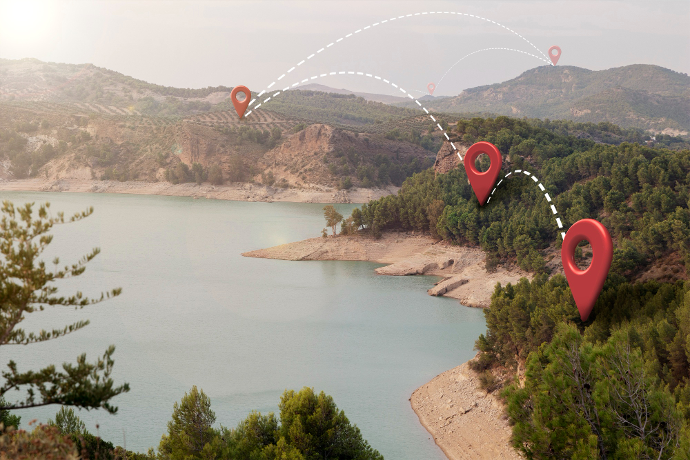
2. GIS Mapping: Users can view and interact with GIS maps, including basemaps, feature layers, and pop-ups.
3. Offline Capability: Can be used offline, allowing users to collect data in areas with limited or no internet connectivity.
4. GPS Integration: Uses GPS to provide location-based data collection and navigation.
5. Integration with ArcGIS Online: The app integrates seamlessly with ArcGIS Online, allowing users to access and update their GIS data in real-time.
Application of ArcGIS Field Maps in Field Data collection
1. Environmental Monitoring: Scientists and researchers use the ArcGIS Field Maps to collect data on environmental parameters such as water quality, air quality, and soil composition.
2. Infrastructure Inspection: Utility companies and infrastructure managers use the app to inspect and maintain infrastructure such as roads, bridges, and pipelines.
3. Natural Resource Management: Foresters, wildlife managers, and conservationists collect data on forest health, wildlife populations, and habitat conditions using the ArcGIS app.
4. Disaster Response and Recovery: Emergency responders and disaster recovery teams collect data on damage assessments, resource allocation, and response efforts using the app.
5. Urban Planning and Development: Urban planners and developers use the ArcGIS app to collect data on land use, transportation, and community development.
What are the Benefits of Using ArcGIS Field Maps in Field Observations
1. Improved Accuracy: The app’s GPS integration and offline capability ensure that data is collected accurately and efficiently.
2. Increased Productivity: The mobile app’s intuitive interface and automated data collection processes reduce the time and effort required for data collection.
3. Enhanced Collaboration: The app’s integration with ArcGIS Online enables real-time data sharing and collaboration among team members.
4. Better Decision-Making: The data analysis and visualization capabilities of the app enable users to make informed decisions based on accurate and up-to-date data.
5. Cost Savings: The offline capability and automated data collection processes of the mobile app reduce the need for paper-based methods and manual data entry, resulting in cost savings.
Conclusion
ArcGIS Field Maps is revolutionizing the way we collect and analyze data in the field. Its intuitive interface, offline capability, and integration with ArcGIS Online make it an essential tool for anyone involved in field observations. Whether you’re a scientist, researcher, or urban planner, ArcGIS Field Maps can help you collect accurate and reliable data, make informed decisions, and achieve your goals more efficiently. By leveraging the power of GIS and mobile technology, ArcGIS Field Maps is taking field observations to the next level. Check out our blog and stay up-to-date with more articles on the world of GIS and more.

You can access the ArcGIS Field Maps app through the
– Apple App Store: For iOS devices, simply search for “ArcGIS Field Maps” and follow the download instructions.
– Google Play Store: For Android devices, you can find the app by searching for “ArcGIS Field Maps” and installing it. And also through the Esri website, which provides more information on the app’s features and capabilities.